Videos
Geology (in German)
When an asteroid impacted in the Alb highlands almost 14.5 million years ago, some rock formations were literally turned upside down. Rock was shattered, ejected and deposited outside the crater as a chaotic mix of broken rock. For a long time the crater was thought to be the result of a volcano. Research in the 20th century provided the evidence that the Ries was formed by a cosmic catastrophe. The unique geology of the Ries was decisive in the region being certified as the “National Geopark Ries.”
Geopark Ries (in German)
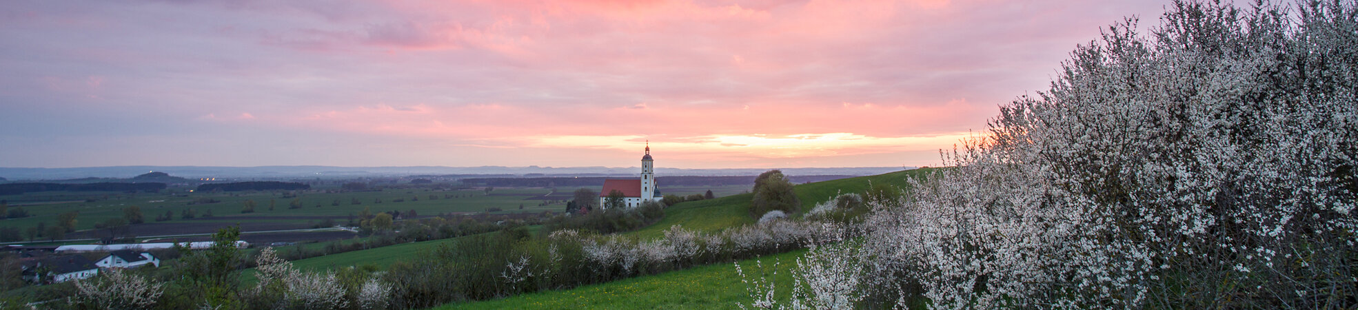
The Geopark Ries represents an absolute top-rank, special geological feature. The “Ries event”—the impact of a meteorite (asteroid) about 14.5 million years ago—affects the region even today. The impact crater Nördlinger Ries is the best preserved crater in Europe. The shallow crater basin has a diameter of 25 km and is largely not forested. The crater basin and up to 150-m-high rim are very visible in the landscape. The Ries Crater is also exceptional because it is densely populated.
From Crater to Crater (in German)
The Geopark Ries bike route ”From Crater to Crater“ travels nearly 185 kilometers, revealing the delightful natural and cultural landscape of the eastern Swabian Alb and the Nördlinger Ries. The route connects the two asteroid craters Nördlinger Ries and Steinheimer Basin and stretches over two circular routes that intersect in Nördlingen. Short, sometimes demanding inclines and fast downhills await the cyclist on the western loop in the direction of Steinheim am Albuch. Towards the East the Crater-Crater Bike Path meanders in a loop through the Ries plain. Regardless whether in stages or as a multi-day tour, cyclists on the Geopark bike path “From Crater to Crater” enjoy riding through a Swabian-Bavarian adventure landscape sprinkled with many, many geological and cultural-historical attractions.
Experience the Geopark (in German)
There are various possibilities to experience the Geopark Ries up close. The Geopark Ries specializes in thematic hiking paths. Well signposted Geopark trails like the Shepherds’ Way combine a leisurely nature stroll with special features relevant to geology, settlement history and nature studies. The bike route “From Crater to Crater” is unparalleled—in three stages and 180 kilometers, it connects the Ries Crater with its “little brother” Steinheimer Basin and thus connects the two impact craters. Or, for those who prefer to listen, a guided tour can be booked with a certified Geopark Ries Tour Guide.
The audio guide is brand new. Experience “Eavesdropping” in the landscape with an iPod that can be borrowed from the Geopark. Or download or order free information about the Geopark Ries from the website.
Nature & Settlement (in German)
The unique geology of the Ries is reflected in the flora and fauna. While dry grasslands and juniper heaths are common on the heights towards the edges of the Ries, the Ries basin offers nutrient-rich soils that have been cultivated for millennia. During the Stone Ages the Ries was one of the most important settlement areas of southern Europe, and the Ries has been considered the breadbasket of Swabia since Roman times. The report gives a short overview of the region’s settlement history but also shows how the environmentally valuable dry grasslands are protected and preserved, especially through the Heide-Allianz Donau-Ries.
Adventure Geotope Lindle
Opened in 2012, “Lindle“ near Holheim was the first “adventure geotope” with nature trail developed by the Geopark Ries. The former limestone quarry became the most impressive exposure accessible to the public in the Geopark Ries. The adventure geotope gives the visitor a glimpse into the so-called “megablock zone” and the tectonic predecessors of the impact event. The nature trail that circles the former quarry is designed as a 3.3-kilometer circular route that takes about 2 hours to walk. A short cut to shorter loop of about 1.8 kilometer is also well marked by signposts. The adventure geotope offers several vantage points, an almost 2.5-meter high tower and a platform with a good view over the entire Ries. Under good weather conditions, both vantage points assure a glorious view of the Ries basin as well as the Ries rim.
10-Year Anniversary, National Geoparks in Germany
On the occasion of the 10th anniversary of the inception of the National Geoparks, the GeoUnion Alfred-Wegener-Stiftung sponsored the production of an animated picture show of all certified Geoparks, at that time 13.
The presentation premiered at the official ceremony in the Hessian state representation in Berlin on 1 March 2012. Along with the GeoUnion, each of the 13 National Geoparks presented display materials in a unified design to the invited guests.
Geotope Kalvarienberg Wörnitzstein
The geotope is located 20 kilometers from the center of the crater in the middle of a geological debris field. This is where the pieces of rock ejected by the meteorite impact rained down as Bunte Trümmermassen.
Especially prominent, the Kalvarienberg rises out of the landscape in Wörnitzstein. After the impact, the cliff came to rest eight kilometers from the southeastern edge of the crater. It was extensively shattered by the shock wave. There is a particularly good view over the Vorries and the Wörnitz valley from the top.
Ries-Panoramaweg
Ein Bloggerpaar hat sich auf den Weg gemacht und den Rieskrater auf dem Ries-Panoramaweg umrundet. Das Video zeigt schöne Einblicke davon.